What’s inside:
This article provides updates on low-pressure areas in the Bay of Bengal and their potential impact on weather in Tamil Nadu and Puducherry.
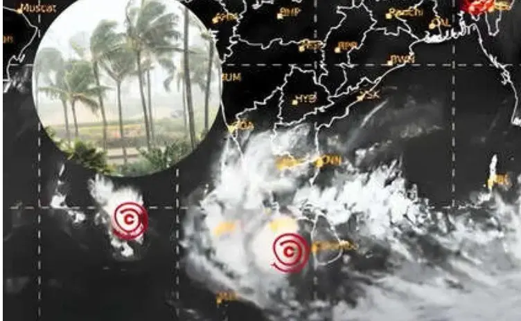
A low-pressure area has formed in the Bay of Bengal, and it could become a depression near the southwest Bay of Bengal and South Andaman Sea by November 24. This information comes from a scientist at the India Meteorological Department (IMD).
The low-pressure system is expected to move northwest. There is a chance it may develop into a cyclonic storm. Another low-pressure system is also active in the Malacca Strait and nearby Andaman region, which could lead to similar weather changes by the same date.
In Tamil Nadu, a yellow alert has been issued for light to moderate rain across several districts, including Kanyakumari and Nagapattinam. Rain is expected to continue until 10 AM on November 23. This could lead to water logging and slippery roads in affected areas.
Some key points to note are:
- Moderate rain has been recorded in Puducherry since Sunday morning.
- Urban areas like Beach Road and New Bus Stand are experiencing rain.
- Orange and yellow alerts were previously issued for various districts in Tamil Nadu.
Looking ahead, residents in affected areas should prepare for potential rain and traffic disruptions. The IMD will continue to monitor the situation and provide updates as necessary.
Summary:
- A low-pressure area has formed in the Bay of Bengal.
- It may turn into a depression and possibly a cyclonic storm.
- Tamil Nadu has a yellow alert for light to moderate rain.
- Puducherry is experiencing moderate rain in several areas.
- Traffic disruptions and water logging are possible in affected regions.


